
Épuisé, mais très demandé!
Paramètres
- 160pages
- 6 heures de lecture
En savoir plus sur le livre
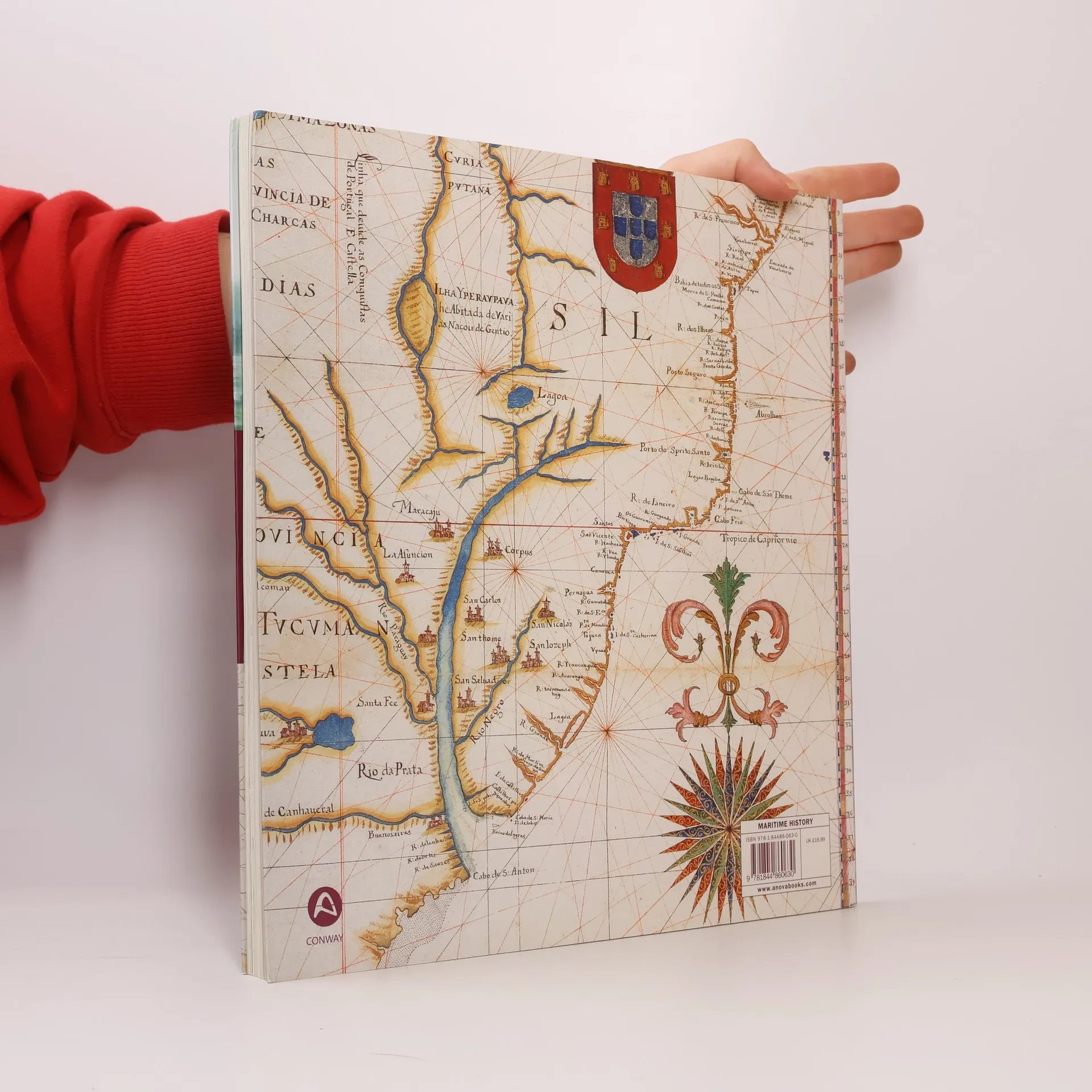
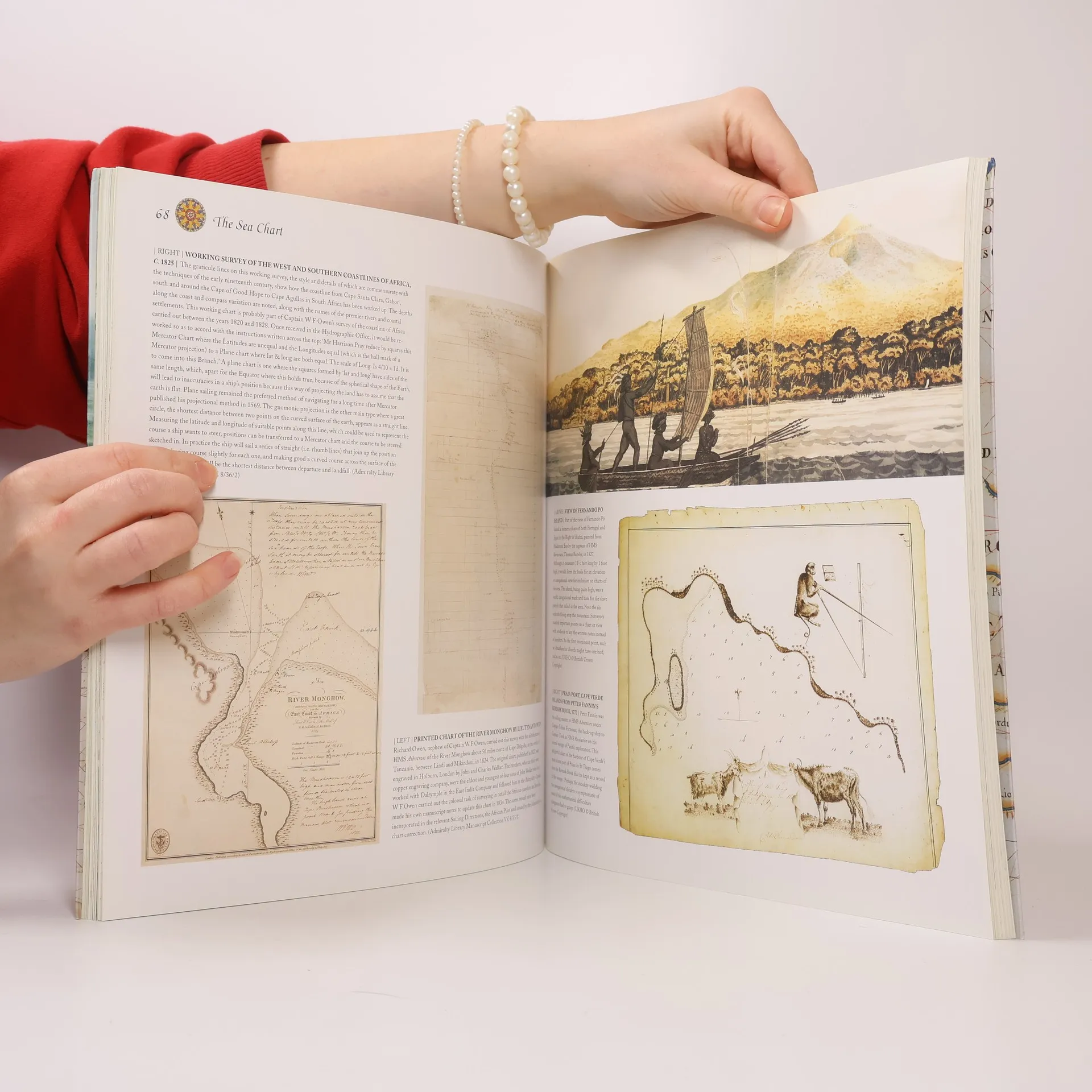
This volume looks at the history and development of the chart and the related nautical map, in both scientific and aesthetic terms, as a means of safe and accurate seaborne navigation. Key figures or milestones in the history of charting are presented in stand-alone story box features.
Achat du livre
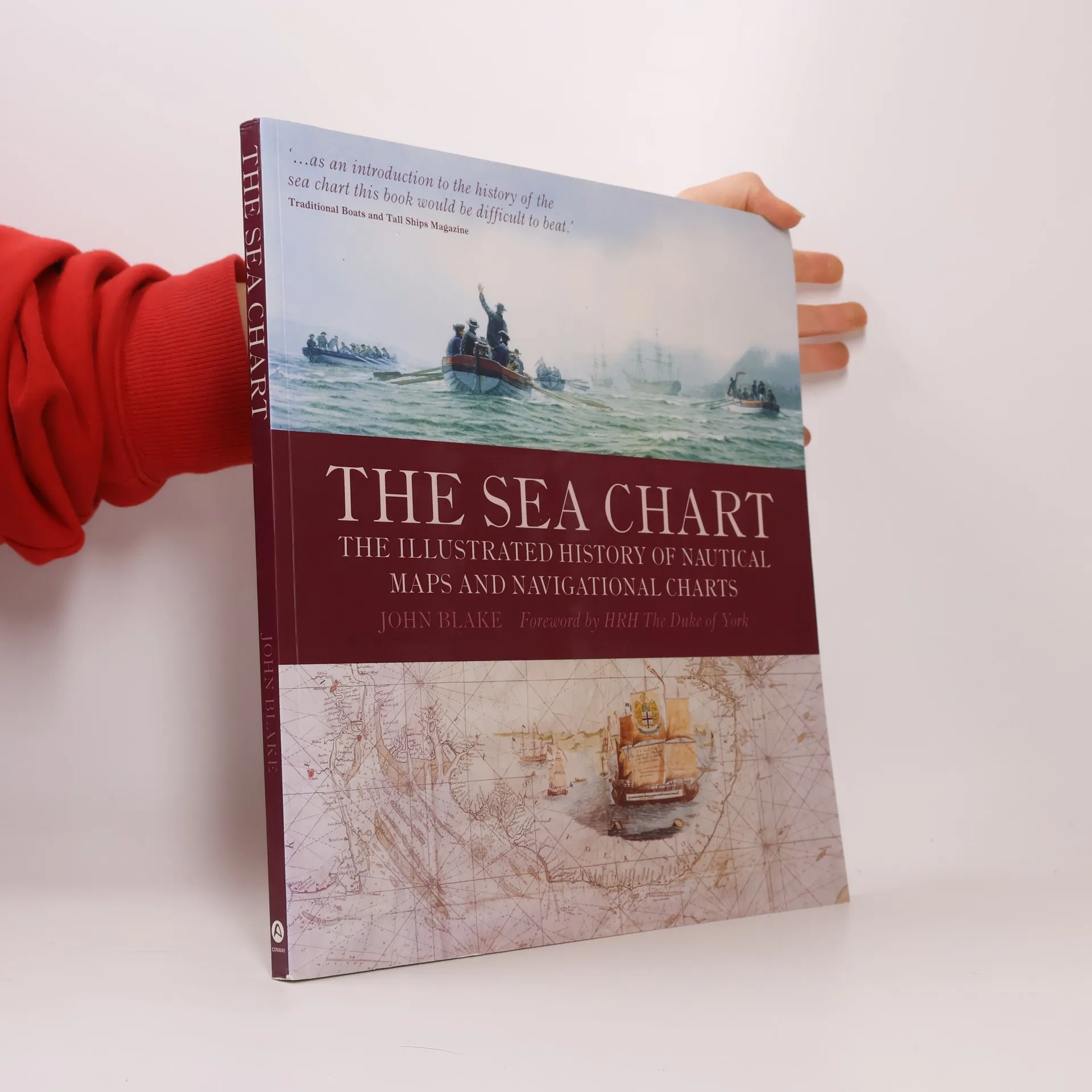
The Sea Chart, John Blake, HRH The Duke of York
- Langue

- Année de publication
- 2009
- product-detail.submit-box.info.binding
- (souple)
Nous vous informerons par e-mail dès que nous l’aurons retrouvé.
Modes de paiement
Il manque plus que ton avis ici.
- Titre
- The Sea Chart
- Sous-titre
- The Illustrated History of Nautical Maps and Navigational Charts
- Langue
- Anglais
- Auteurs
- John Blake, HRH The Duke of York
- Éditeur
- Conway Maritime Press
- Publié
- 2009
- Format
- souple
- Pages
- 160
- ISBN10
- 1844860639
- ISBN13
- 9781844860630
- Séries
- Mots clés
- Nonfiction, Thème historique, Cartes et voyages, Technologie & Ingénierie, Géographie & Topographie, Manuels et guides, Science, Voitures & Transports, Navires, Navigation maritime, Cartographie, Géographie historique, Navigation
- Évaluation
- 4,65 sur 5
- Description
- This volume looks at the history and development of the chart and the related nautical map, in both scientific and aesthetic terms, as a means of safe and accurate seaborne navigation. Key figures or milestones in the history of charting are presented in stand-alone story box features.