Acheter 10 livres pour 10 € ici !
Bookbot

Nigel Morgan

    Nigel Morgan est un historien de l'art distingué, spécialisé dans les manuscrits médiévaux et les vitraux du XIIIe au XVe siècle. Ses recherches explorent les manuscrits enluminés et liturgiques, se concentrant sur leur iconographie, leur liturgie et l'interaction entre le texte et l'image dans l'art dévotionnel de la fin du Moyen Âge. Morgan offre également des perspectives approfondies sur l'art scandinave, y compris la peinture sur panneau et la sculpture sur bois des XIIIe et XIVe siècles. Ses contributions académiques fournissent de précieuses perspectives pour la compréhension et l'interprétation des œuvres d'art médiévales.

    Preston (West) 1909
    Central Preston 1909
    The golden age of English manuscript painting 1200-1500
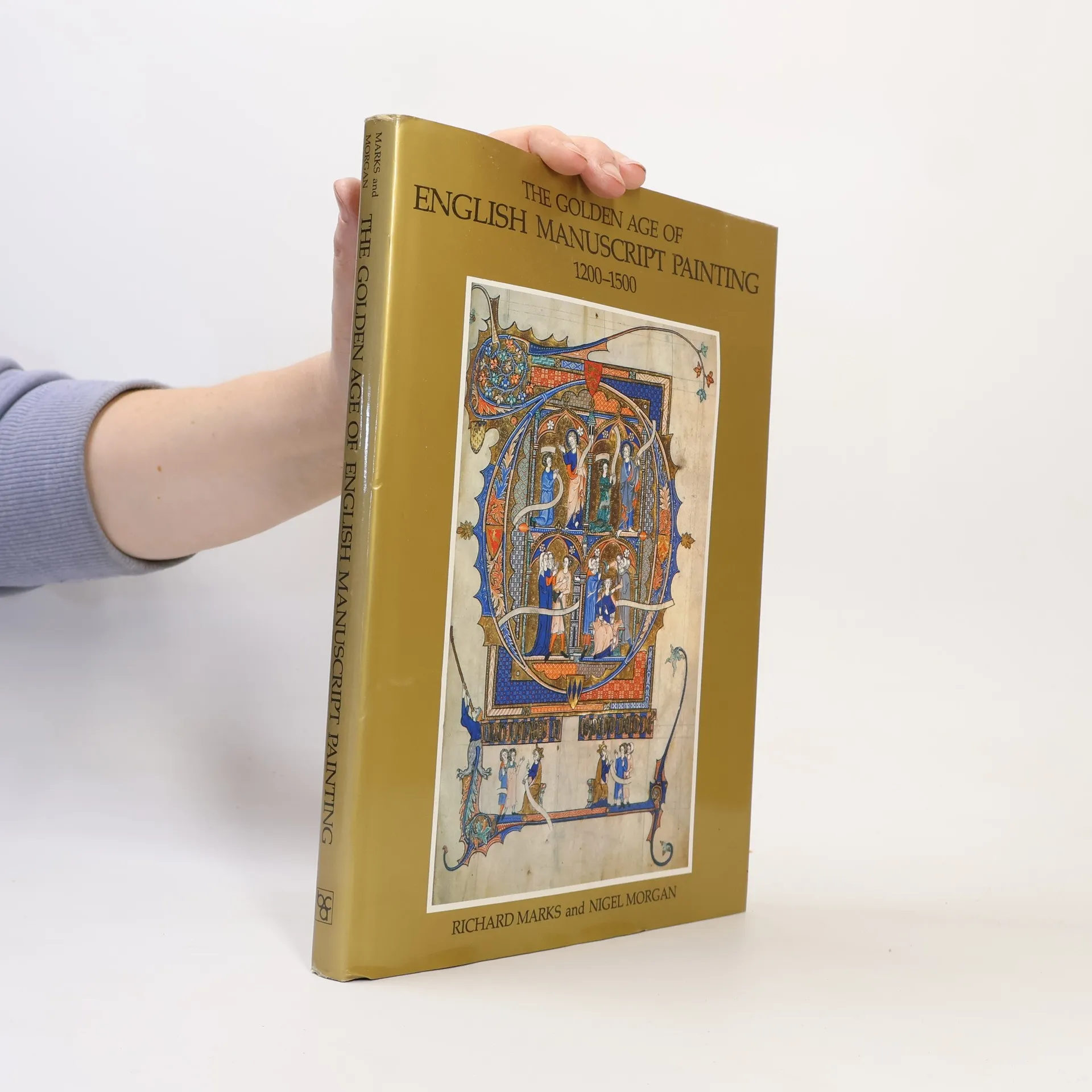
    • Forty colour plates illustrate some of the finest achievements of medieval painting. The authors discuss the importance of the Anglo-Saxon tradition of drawing in 13th century illumination, the role of the Court in the introduction of the French style of illumination, the elaboration of marginalia, and International Gothic style.

      The golden age of English manuscript painting 1200-1500
    • Here are the details of maps for Preston: Lancashire Sheet 61.10 Central Preston 1909 - published 1993; intro by Nigel Morgan. ISBN.978-0-85054-592-0 This detailed map covers the central area of Preston, with coverage stretching from Adelphi Street eastward to Acregate Lane, and from St Thomas's Road southward to Syke Street. Most of the town centre is shown, and features include Fishergate, Church Street, tramways and depot, Yard Works, Royal Infirmary, Deepdale Enclosure, St Peter's church, Town Hall, St John's church, New Preston Mills, Alliance Works, Fishwick Mills, India Mill, Peel Mill, Deepdale Mill, Alexandra Mill, Victoria Mills, Deepdale Siding, Park Mills, Bute Mill, Marathon Skating Rink, Market Place, Sovereign Mill, St Paul's church, Green Bank Mills, St Ignatius's RC church, Cliff Mill, Ribbleton Mill, Albert Mill, Wharton Mill etc. Note that the station is just off the map to the south. We include selections from a street directory on the reverse, incl Back Lane, Corporation Street, Deepdale Road, Lune Street, Tithebarn Street. The map links up with Sheet 61.09 Preston (West) to the west.

      Central Preston 1909
    • Here are the details of maps for Preston (West): Lancashire Sheet 61.09 Preston (West) 1909 - published 1994; intro by Nigel Morgan. ISBN.978-0-85054-666-8 This detailed map covers the western part of Preston, including the dock area. Coverage stretches from Brook Street westward to Ashton Park, and from Eldon Street southward to the River Ribble. Features include railways with LNWR engine shed, Greenbank Goods station, Maudland Goods station, Maudland Viaduct, lines in docks; English Electric Works, United Electric Car Works, Albert Edward Dock, Spa Mill, Wellfield Road Mill, StWalburge's RC church, Caledonian Mill, Fylde Road Mill, Soho Foundry, Lancaster Canal, tramways, Aqueduct Mill, Progress Mill, Eldon Street Mill, Brookhouse Mill, Shelley Road Mills, Arkwright Mill, Ashton on Ribble area, Ashton Park, Tulketh Hall etc. On the reverse we include extracts from a street directory, incl Fylde Road, Marsh Lane, Maudland Bank, Waterloo Road, Waterloo Terrace, Watery Lane. The map links up with Sheet 61.10 Central Preston to the east.

      Preston (West) 1909